A 55 mile trail running challenge, covering 13 limestone summits around the Kent Estuary feeding into Morecambe Bay.
The Bay Limestone Round was established in the summer of 2020 by local Tom Phillips, as a way to get some long distance routes in whilst the world was in lockdown. In addition it has proven to be a great way for people to raise funds for charitable causes, with £12,000 raised in 2020.
In the first 12 months since Tom’s initial completion, 38 solo rounds have been completed before a little lull in completions, until our very own Mike Binks completed his and number 39th Bay Limestone Round.
Mike Binks, famous in our Rock+Run world, works hard behind the scenes to keep the business running smoothly and efficiently. Knowing that this was a challenge unlike anything he had attempted before, we sat down with Mike to ask him a few questions about the route.
What is the Bay Limestone Round?
The Bay Limestone Round is a 55 mile route in the South Lakes. You start in Arnside, catch the train across to the other side of the river estuary to Kent's Bank then run round the river estuary with a few limestone hills in the way.
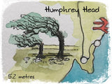


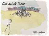


More specifically the summits being Humphrey Head, Hampsfell, Lords Seat, Cunswick Scar, Scout Scar, Heversham Head, Farleton Knott, Hutton Roof Crags, Cringlebarrow, Heald Brow, King Williams Hill and finally Arnside Knott totalling 8000 feet of ascent. The question is can you get to the finish line on Arnside Pier in time for the pub, or if you are are quick, fish and chips.

Whats the terrain like and how hilly is it?
A mix. On the whole you are following footpaths and bridleways. Even on the open fells you are generally following established paths. You start traversing the coastline and after leaving that you have a mix of limestone hills, fields, woods, an old railway line, canal towpath and a few short sections of back country roads to link sections.
How did you find out about the route and what set the wheels in motion?
Funnily enough I was looking at finding a route that involved a similar start, taking a train from Arnside across the viaduct to Grange then running back round the estuary. I was talking to friends about it and they pointed me in the direction of The Bay Limestone Round.
I wanted to do something for my 40th birthday, but didn't quite know what. Then during a morning of bouldering at Woodwell I re-thought about the round and straight afterwards I went to hunt down one of the more elusive summit cairns. This was about 2 months before my attempt, so I guess that's when I started thinking about it more seriously.
This set off a series of runs checking out some of the hills and connecting paths. Luckily for me Rock+Run is surrounded by all the hills on the round, and apart from a few linking sections I am pretty familiar with the area, whether from post work climbing or running.


Why did you decide to do it during the wettest week of the year and without support?
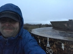
As I said I wanted to do something on my 40th birthday, because why not. In the end I actually delayed by a day to avoid the worst of the weather whilst The Lakes was getting flooded. On the actual day, it was throwing it down in the morning with lots of flooded ground.
In regard to support, I quite like a day outdoors by myself, so no company is very normal for me, especially when running. The route has two shops to resupply with food and water so I felt that I didn't need road support or the like.
What were the highs and lows of the route?
The high was definitely setting out and the excitement of the unknown. I’ve never attempted anything this distance. I’ve done a few runs marathon distance, but never anything twice as long, so I was pretty excited to see if it was possible. Even when I was moving well after 30 plus miles, that felt good, but towards the end I was really struggling. I found it pretty hard at the end. I wouldn’t say I was done, but I just couldn't run anymore.
Were there any points where you struggled to find the route?
The route itself is pretty easy to follow, there are a couple of summits towards the end where the reccying I had done was definitely worthwhile, especially considering I was in the dark at this point. Side note, for those wanting to give it a go, check out Cringlebarrow and Heald Brow beforehand.
On the actual day, I did have to make a few miles detour, as I wouldn’t have been able to get across one of the river valleys due to flooding, so I had to head upstream just on the road instead.



How did you prepare for it?
I did a bit of reccying and did a few longer runs beforehand. I didn’t prepare as much as I would have liked, so I just decided to go for it and see what would happen. Ideally some longer runs would have been helpful to potentially push for a quicker time.
Mostly I just familiarised myself with the map, in the end apart from one short section I ran off memory. Then made sure I had enough electrolytes with me and a pre-booked train ticket.
How has the recovery been since?
I spent a lot of time on my feet, but it wasn’t particularly fast so my legs weren’t too bad, but it was the first time ever I had issues with swollen feet, it probably didn’t help that half the time my feet were in water to some extent but they didn’t hold up too badly. I don’t think anyone at work was laughing too much at me hobbling around for the few days afterwards.
Any other plans on long distance routes in the future?
Hmmm, watch this space. I don’t like putting pressure on myself. For those that know me, I’m quite a fan of maps and I always like looking for potential ideas. There’s a few in there but nothing set in concrete yet.
Tell us about the charity you did it for?
So part of the limestone round, you’re supposed to raise money for charity. I didn't do any fundraising (slaps wrist) so I decided to put a donation in myself for Arrhythmia Alliance.
Arrhythmia Alliance are a charity that spreads awareness of heart arrhythmias and how to treat them. This is particularly relevant for me because I had an operation almost a year ago to sort out my arrhythmia which has made a world of difference to me, especially with the problems I have been having for many years. Donating to them seemed an obvious thing to do.
Anything else?
Shout out to Tom Phillips who designed the route. Altogether it’s pretty good, the hills are great, and the connecting part had some surprisingly good sections. So yeah, I would highly recommend, though I have been told summer attempts can be quite vegetated.
The round can also be completed in a team relay, split into 5 legs for those interested in a shorter challenge.
Complete the round and you get a certificate and added to the roll of honour.
For more information check out the Bay Limestone Round Website.
Thanks Mike
Thanks to Mike for putting in a monumental effort on the Bay Limestone Round, putting in a sizeable donation for a reputable charity, and being an all round Rock+Run legend!


